
Two towns, one harbour
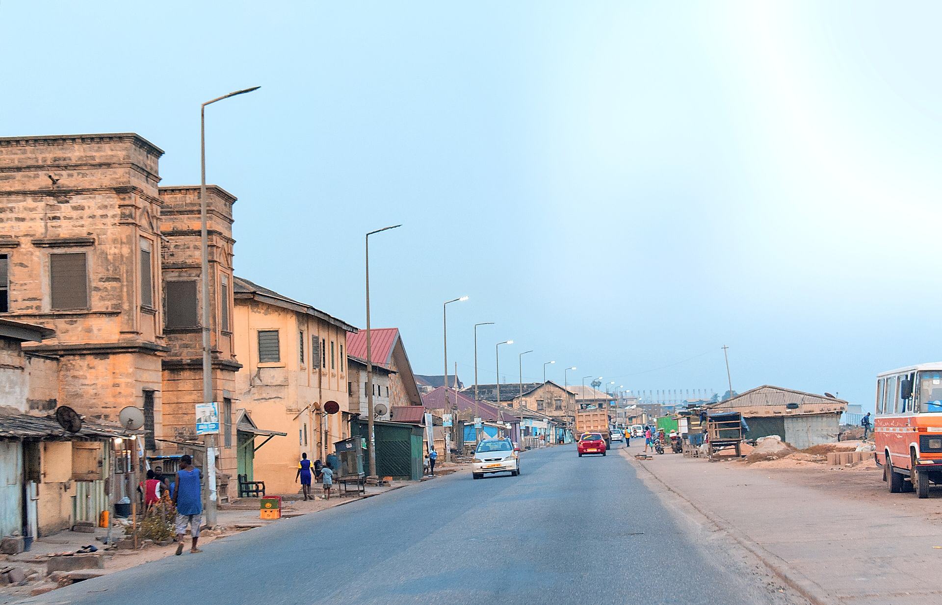
Sekondi is the older and larger of the pair, and it was here that the Dutch built Fort Orange, Fort Witsen and Fort Sekondi in the 17th century. British and Dutch traders held such influence that the town effectively split into "British Sekondi" and "Dutch Sekondi"; both European settlements collapsed after the Dutch formally left in 1872. The name Sekondi itself is said to derive from the word "second", after the settlement was chosen as the second site for a shallow-water harbour.
Takoradi's name is more contested. One account traces it to Ntakorase, "under the ntakor tree", blended with the Portuguese name for the settlement, Taccarada; another points to the Ahanta expression Takora-adi, "under the takore tree". The tree in question is now extinct. Before the Portuguese arrived the place was known as Amanfulkro, town of Amanful.
What changed everything was infrastructure. A railway built in 1903 carried minerals and timber from the hinterland to the coast, and in 1928 Ghana's first deepwater seaport opened at Takoradi. The two towns amalgamated on 2 December 1946. During the Second World War, RAF Takoradi was a staging point for British aircraft bound for Egypt: Spitfires arrived in crates from England, were assembled here, and flown on via Nigeria and Sudan to Libya. Some South African airmen who flew anti-submarine patrols over the Atlantic are buried in the Takoradi European Public cemetery.

Forts, and what they were for
Fort Orange began in 1642 as a lodge of the Dutch West India Company, became a trading post in the 1670s, and was enlarged into a full fort in 1690 to support the growing European trade and to defend against local conflicts and rival European powers. In September 1694 it was attacked by the Ahanta, and the structure was reinforced and remodelled into a full fortification by 1704. Its cannons were pointed mainly at the nearby British trading lodge.
It sits beside Fort Sekondi, the English fort built in 1682. In 1872 Fort Orange passed to British control along with the rest of the Dutch Gold Coast, and it has since served as a lighthouse and as a naval base for the Ghana Ports and Harbours Authority. It is part of the UNESCO World Heritage listing for the Forts and Castles of the Volta, Greater Accra, Central and Western Regions.
These forts were commercial instruments in a trade that included enslaved people, and the wealth they guarded was built on it. Standing at the water's edge in Sekondi, it is worth holding both facts at once: the engineering skill and the human cost. Ghana's larger castles at Cape Coast and Elmina carry that history at greater scale, and many travellers pair them with this coast.

People, markets and the Kundum season
The city's population is majority Christian, with a substantial Muslim minority, and the main peoples are Fante, followed by Ahanta, Nzema, Asante and Wassa. Fishing is the most common occupation. The Albert Bosomtwi-Sam Fishing Harbour in Sekondi is among the largest fishing ports in the region, and the Takoradi Market Circle is the commercial hub of the Western Region.
The Market Circle was planned by city engineers to form the nucleus of trade for the new town, built in a large circle with its stores arranged to shape it. It grew busy after the harbour opened and migrants arrived for work; by the late 1980s it was congested enough that a second market was planned and built at Apremodo, about 10 kilometres away.
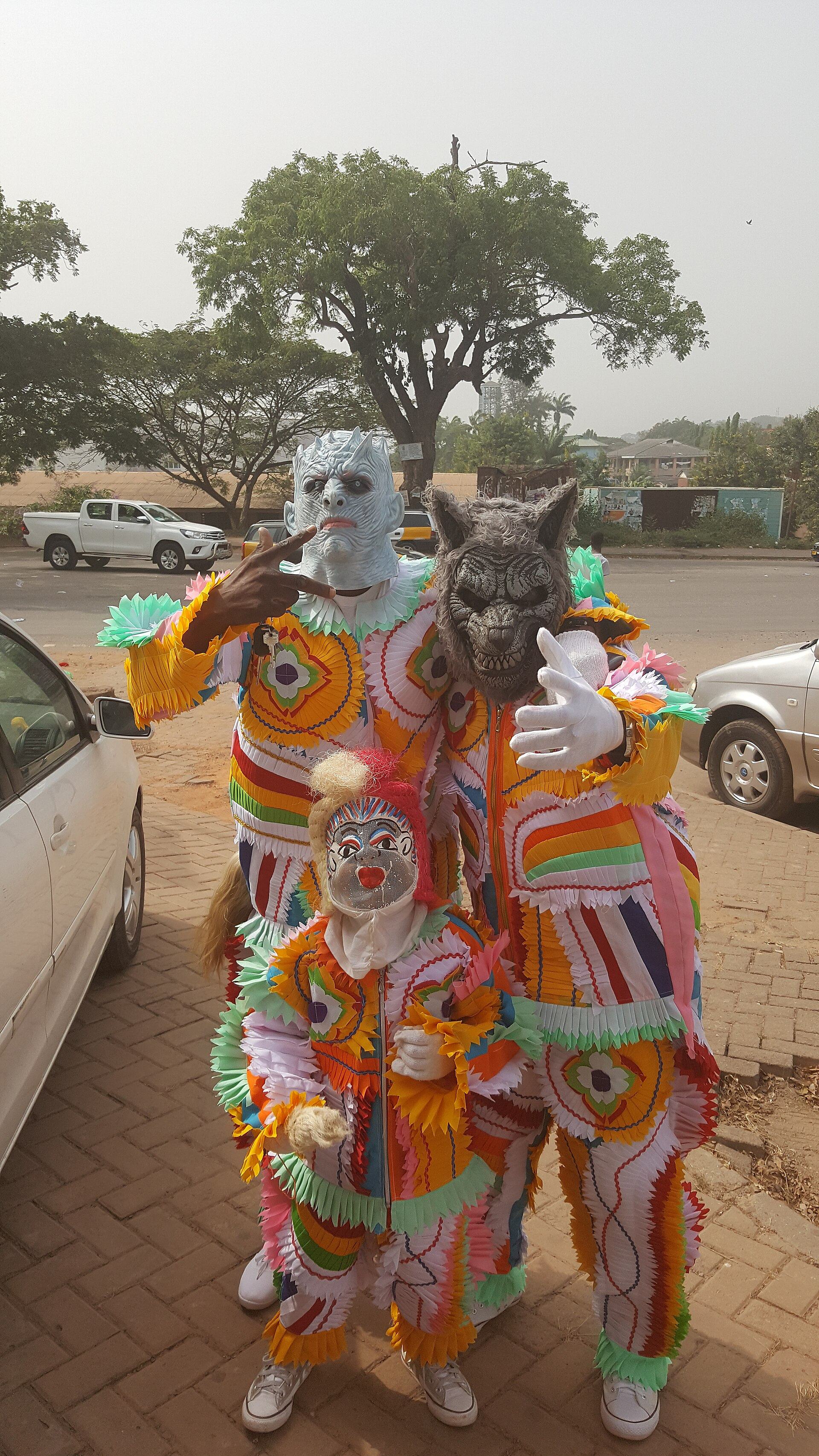
Culturally, the Western Region's great festival is Kundum, celebrated by the Ahanta and Nzema peoples to thank God for the abundance of food at harvest. Oral tradition says it began when a hunter named Akpoley came upon dwarves dancing in a circle and brought the dance home; another version ties its start to the ripening of a palm tree's fruit, which became a calendar for the community. The festival runs for four weeks, with drumming and dancing at night on the town's outskirts for the first three weeks, then a final week of ritual: a fire lit at the chief's palace, sacrifices in the stool room, the chief entering on a palanquin, and a great feast on the final Sunday. Crucially for visitors, it moves from town to town, so missing it in one place does not mean missing it altogether.

The landscape inside the city
The metropolis covers about 191.7 square kilometres, bordered by Ahanta West District to the west, Shama District to the east, Wassa East District to the north and the Gulf of Guinea to the south. Its landscape is more varied than the port skyline suggests: an eroded coastline, a low-lying central area, undulating ridges and hills, cut by the Whin and Kansawora rivers and the Essei and Butre lagoons.
That topography is why a forested hill with a resident monkey population sits within the city itself, and why the Atlantic shoreline from New Amanful to Essipon draws people out on festive occasions. The forest areas in the north-east of the metropolis also support the timber and construction trade that has long underpinned the local economy.
The climate is tropical savanna: hot all year, with an average annual high around 28°C and low around 22°C, and the hottest stretch from January to May. The dry season is short, from December to March; the wet season falls between May and June, with June the wettest month. Because the city sits near the Anankwari, Kansawura and Whin rivers, heavy rain can cause flooding, and past floods have displaced residents in neighbouring communities.

What to do
Things to do in Takoradi
-
Attraction
1.Fort Orange, Sekondi
The city's most significant historic structure, and the reason to start any visit in Sekondi rather than Takoradi. Built by the Dutch in 1642 as a trading lodge, enlarged into a fort in 1690 and rebuilt after an Ahanta attack in 1694, it stands a few metres off Sekondi's harbour beside the English Fort Sekondi of 1682. It is part of the UNESCO listing of Ghana's forts and castles, and now serves as a lighthouse and a Ghana Ports and Harbours Authority naval base.
Tip: It is an active naval site, so access can be restricted and photography may be limited. Ask locally before travelling out, and treat any visit as a privilege rather than a right.
-
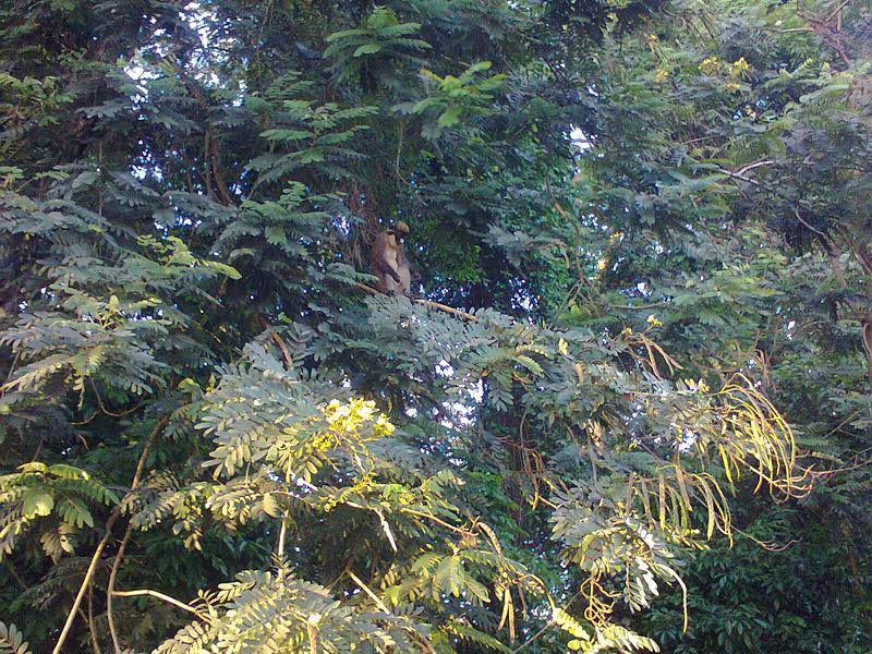
2.Takoradi Monkey Hill
A forested hill and primate habitat inside the city, listed by the Sekondi-Takoradi Metropolitan Assembly among its tourist sites. It is the easiest way to understand the metropolis's real shape: from the ridge you see the low-lying centre, the ridges and the coastline that the district profile describes. The Assembly has announced plans to redevelop the forest into a modern eco-tourism park through a public-private partnership, including additional animal species and improved visitor amenities.
Tip: Because redevelopment is only at proposal stage, facilities may be basic. Go for the walk and the view, and check with the Assembly or a local guide on current access.
-
Attraction
3.Akatekyi Crocodile Pond
About 30 kilometres west of Takoradi, near the fishing community of Akatekyi, this pond holds crocodiles that the local community considers sacred and part of its cultural identity. Visits are arranged through a traditional spiritual leader, and the crocodiles emerge at his chants and incantations, or when enticed with live fowls. It is a cultural site first and a wildlife sighting second, which is exactly what makes it memorable.
Tip: Visitors may bring a bottle of schnapps for libation. The pond admits the public every day except Wednesdays, which are sacred days.
-
Beach
4.Vienna City Beach
A beach and leisure venue on Beach Road in Takoradi's Harbour Area, operated by Vienna City Limited. After a morning of forts and markets it is the obvious place to slow down: the Atlantic here is the same water that made the harbour possible, and the shoreline from New Amanful to Essipon is where the city comes out to relax. Good for an unhurried afternoon rather than a full day.
Tip: The coast is open and exposed; take sun protection and keep an eye on the surf, which can be stronger than it looks.
-
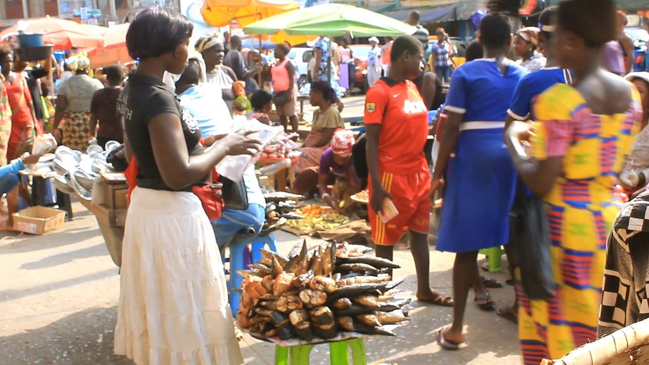
Photo: MPIMPIMHENE Nana Gyetuah Eric · CC BY-SA 4.0 · Source 5.Takoradi Market Circle
The commercial and economic hub of the Western Region, planned by city engineers as the nucleus of trade for the new town and built in a large circle, with its stores arranged to form the shape. It is the most accessible point in the metropolis, reached by John Mensah Sarbah Road, Liberation Road, Ashanti Road and Ahanta Road, and most major banks have branches around it. Come for provisions, cloth and a sense of how the city actually works.
Tip: It is busy and congested, with hawkers working the walkways and parking areas. Keep valuables close, go earlier in the day, and expect to bargain.
-
Attraction
6.Apremdo Palace
A traditional palace and cultural site in the Apremodo area of Takoradi, described by directories as a small museum of local artifacts. Apremodo is a suburb about 10 kilometres from the Market Circle, and it is where a second market was built once the central one became congested in the late 1980s. The palace is a quieter, more personal counterpoint to the port and the forts: local material culture, kept by the community that made it.
Tip: This is a traditional institution, not a museum with fixed opening hours. Ask permission before entering or photographing, and consider going with a guide who can introduce you.

Plan your time
Suggested itinerary
Half a day: Sekondi's waterfront and the market
Start in Sekondi at Fort Orange, the 1642 Dutch lodge turned fort, standing beside the English Fort Sekondi of 1682 and now a lighthouse and naval base. Walk the harbour edge and watch the fishing boats at the Albert Bosomtwi-Sam Fishing Harbour, the trade that still employs more people here than anything else. Then cross to Takoradi and spend the afternoon in the Market Circle, the circular trading heart of the Western Region, before finishing with an hour at Vienna City Beach on Beach Road as the light goes.
Fort Orange (Sekondi)→Vienna City Beach
One day: city, hill and coast
Morning at Fort Orange in Sekondi, then Takoradi Market Circle for the middle of the day. In the afternoon climb Takoradi Monkey Hill for the view over the low-lying centre, the ridges and the coastline, and to see the forested hill that the Assembly wants to turn into an eco-tourism park. Finish at Vienna City Beach.
Fort Orange (Sekondi)→Takoradi Monkey Hill→Vienna City Beach
Two days: add the sacred west
Day one as above. On day two, drive west about 30 kilometres to the Akatekyi Crocodile Pond, where the crocodiles are sacred and visits are arranged through a traditional spiritual leader; remember that Wednesdays are sacred days and the pond is closed to the public. If your timing coincides with Kundum, follow the festival to whichever Ahanta or Nzema town is celebrating that week. Return to the city in the evening.
Akatekyi Crocodile Pond

Seasons and festivals
When to go
Sekondi-Takoradi is hot all year, with an average annual high of about 28°C and low of about 22°C. The hottest stretch runs from January to May, around the time the wet season begins. The dry season is short, from December to March; the wet season falls between May and June, and June is the wettest month, averaging 346 mm. Humidity peaks in August after the rains and is lowest in December. Sunshine is most generous in November, and shortest in September. Because the city sits close to the Anankwari, Kansawura and Whin rivers, heavy rain can cause flooding, so build slack into travel plans in the wet months.
- Kundum Festival · July to November, moving town to town
- Celebrated by the Ahanta and Nzema peoples of the Western Region to thank God for the abundance of food at harvest. It runs for four weeks: for the first three weeks drumming and dancing happen at night on the outskirts of town, then the final week brings a fire lit at the chief's palace, sacrifices in the stool room, the chief entering on a palanquin, and a great feast on the final Sunday. Each town schedules its own start, and the festival moves from place to place, so you get another chance if you miss it locally.
Access
Getting there and around
Takoradi Airport (TDI) lies about 5 kilometres from Sekondi and provides air links to other parts of Ghana and to international destinations. The city is well connected by road and rail, and public transport runs from Takoradi to major cities including Accra, Kumasi, Cape Coast, Sunyani, Tamale, Tema, Ho, Wa, Bolgatanga, Techiman, Mim and Elubo. Sekondi-Takoradi sits on the main railway lines to Kumasi. The port is a working hub, with shipping lines serving other West African countries and Europe.
Within the metropolis, the Market Circle is the most accessible point in the city, reached by John Mensah Sarbah Road from the south-west and north-east, Liberation Road from the south-east through the market to the north-west, and by Ashanti Road and Ahanta Road. Distances to the west are real: Akatekyi is about 30 kilometres from Takoradi, and Apremodo about 10 kilometres from the Market Circle. Fort Orange is an active naval base, so confirm access before you travel out to it.
Good to know
Before you go
This is a working port city, not a resort, and it rewards travellers who plan around that. Fort Orange is a Ghana Ports and Harbours Authority naval base as well as a historic monument, so access may be restricted; ask before you go rather than assuming entry. The Akatekyi Crocodile Pond is a sacred site: visits are arranged through a traditional spiritual leader, Wednesdays are sacred days when the public is not admitted, and bringing a bottle of schnapps for libation is customary. At Apremdo Palace, ask permission before entering or photographing.
Dress modestly for shrines, palaces and churches. Carry cash for markets and small sites, and keep valuables close in the congested Market Circle. The wet season brings real flooding risk near the Anankwari, Kansawura and Whin rivers, so avoid low-lying routes after heavy rain. Finally, remember that Kundum and Ankos dates shift and are confirmed locally, so check with the Assembly or a local guide before building a trip around a festival.

FAQ
Questions travellers ask about Takoradi
Why is Sekondi-Takoradi called the Oil City?
The discovery of oil in the region in 2010 led to Sekondi-Takoradi becoming known as the "Oil City". It is also the capital of the Western Region and the region's largest city, with a population of 245,382 at the 2021 census.
Is Fort Orange open to visitors?
Fort Orange is part of the UNESCO World Heritage listing of Ghana's forts and castles and is open to the public, but it currently serves as a naval base for the Ghana Ports and Harbours Authority, so access can be restricted. Confirm before travelling out to Sekondi.
When is the best time to visit Takoradi?
The dry season runs from December to March and the wet season from May to June, with June the wettest month. Temperatures are hot year-round, with the hottest period from January to May and the lowest humidity in December.
Can I visit the Akatekyi crocodile pond on any day?
The public is admitted from Sunday to Saturday except Wednesdays, which are sacred days. Visits are arranged through a local traditional spiritual leader, and visitors may bring a bottle of schnapps for libation.
What is the Kundum Festival and when is it held?
Kundum is a harvest and religious festival celebrated by the Ahanta and Nzema peoples of the Western Region to thank God for the abundance of food. It lasts four weeks, and because each town schedules its own start and the festival moves from place to place, it is celebrated at different times across the region.
How do I get to Takoradi?
Takoradi Airport (TDI) is about 5 kilometres from Sekondi and offers air links within Ghana and internationally. The city is also well connected by road and rail, with public transport to Accra, Kumasi, Cape Coast and other major cities, and it lies on the main railway lines to Kumasi.
Is Takoradi a good base for exploring the Western Region?
Yes. The city has the region's airport, its main railway lines, a working port and road links to the coast and interior, and attractions such as the sacred Akatekyi crocodile pond lie west of it along the Nzema coast.
In pictures
Takoradi in pictures
Keep exploring
More destination guides
Sources for this guide (9)
- Sekondi-Takoradi — Wikipedia
- Fort Orange, Ghana — Wikipedia
- Fort Orange — Visit Ghana (Ghana Tourism Authority)
- Akatekyi Crocodile Pond — Visit Ghana (Ghana Tourism Authority)
- Kundum Festival — Wikipedia
- Kundum Festival — Visit Ghana (Ghana Tourism Authority)
- Takoradi Market Circle — Wikipedia
- Sekondi-Takoradi Metropolitan Profile: Topography and Drainage — Ghana Climate Vulnerability Hub
- STMA to develop Monkey Hill Forest into modern eco-tourism park — Ghana News Agency
Written September 29, 2026 from these sources and reviewed by the VisitGhana.app team. Confirm practical details locally before travelling.


