
A fort older than most of the coast's story
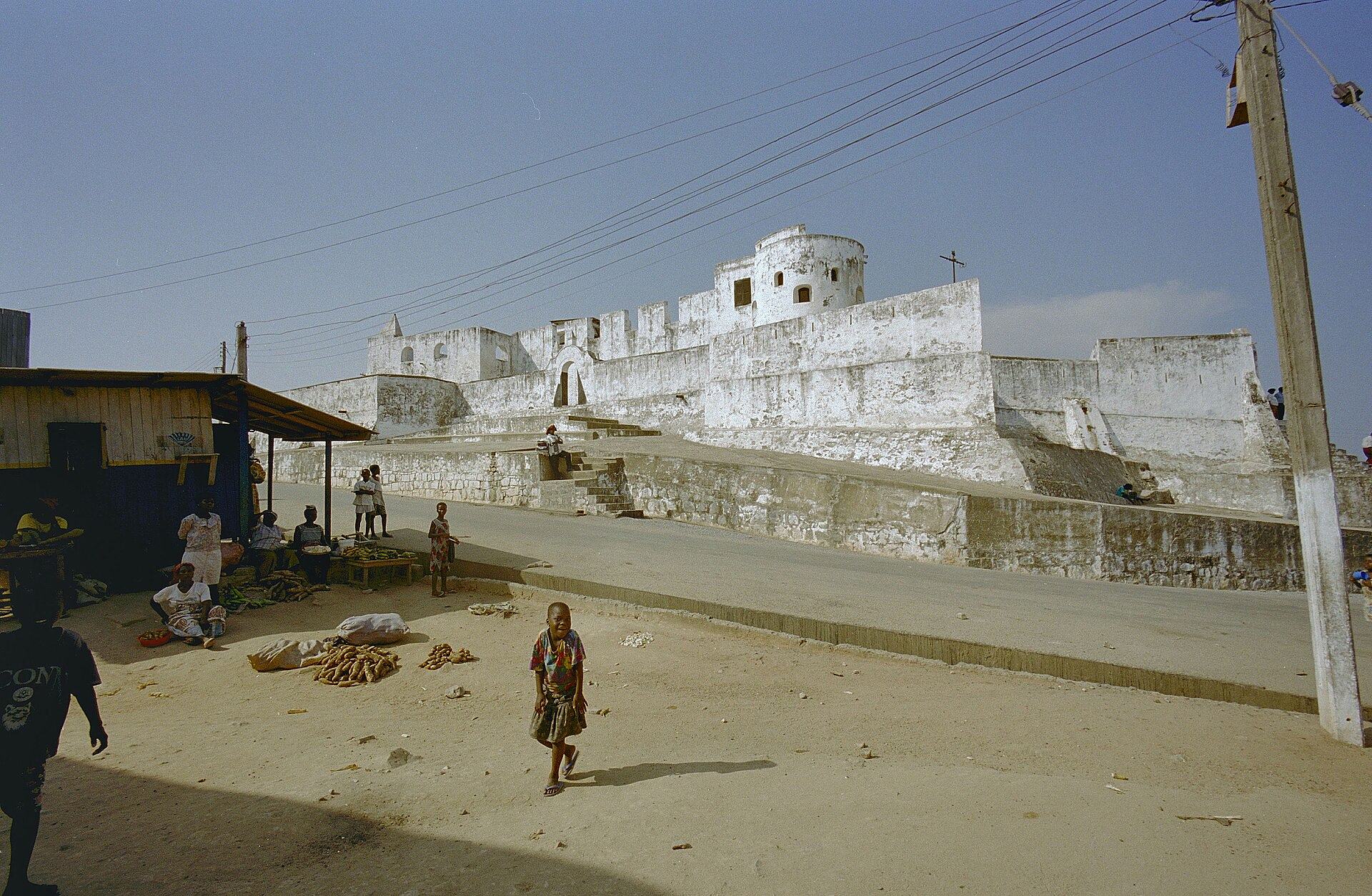
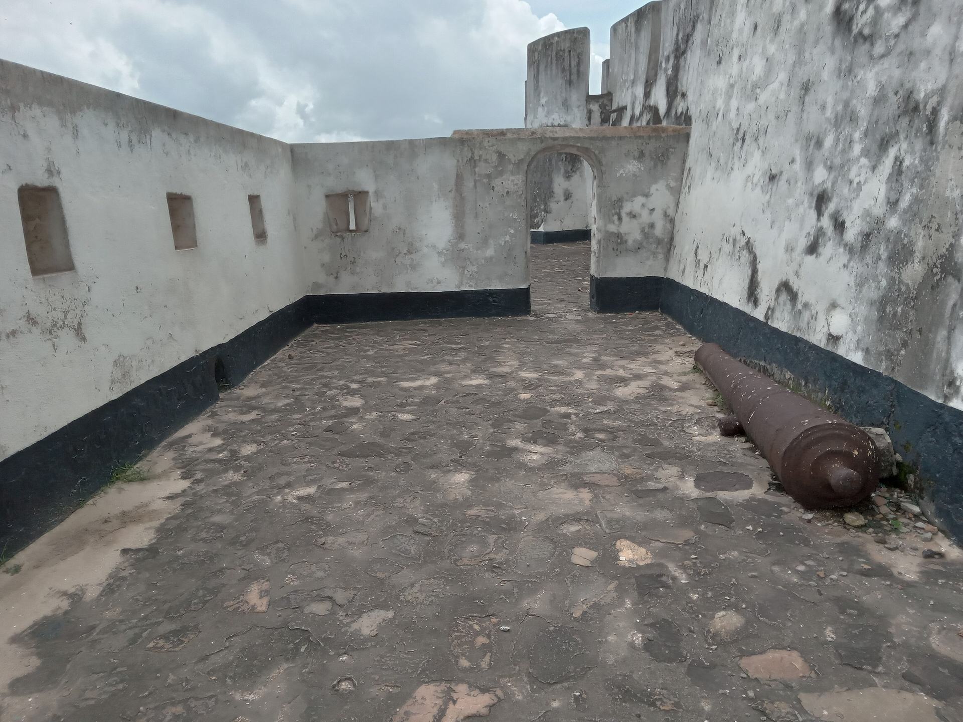
Fort San Sebastian is Ghana's third oldest fortification, built by the Portuguese between 1520 and 1526. Its original purpose was blunt: to deter English sailors from interfering in the trade at Shama. The Ghana Museums and Monuments Board describes it as a small-scale copy of St George's Castle at Elmina, and notes that it earned a mention in Di Castaldi's Venetian map of 1564. When the Dutch took it over in 1638 it was a ruin; major renovation between 1640 and 1643 substantially expanded the structure, and Dutch West India records show some trade in gold and slaves there, though by 1705 the company's official view was that the fort served mainly as a source of fuel wood and water. It was ceded to the British in 1872. Rehabilitated in 1957, it is now a National Monument and part of the UNESCO-listed Forts and Castles of Ghana, inscribed in 1979. It is also, remarkably, still in daily use — as a post office, a magistrate's court and offices for the Electoral Commission.
The fort's graveyard holds Anton Wilhelm Amo, the first black European university professor, who lies interred here. A Ghana News Agency visit recorded the compartments shown to visitors: the gate, the male and female dungeons where enslaved people were held for months before departure, the room where the remains of those who died before shipment were kept, and the tunnel used to move them to the ships. This is not a comfortable visit, and it should not be. Walk it slowly, and let the building speak for itself.

The cross in the sea and the first European landfall
Out in the water off Shama stands a cross — the Cross in the Sea, or White Cross — which local accounts link to the arrival of Portuguese sailors on this coast in 1471. The GNA reported being shown a metal-like cross erected at a small island in the sea by Portuguese missionaries, still standing, along with a make-shift structure said to have sheltered the Portuguese for five years before the fort was completed. Whatever the precise sequence of events, the cross marks Shama's place in the earliest phase of European maritime expansion on the Gold Coast — the moment of first contact, long before the trade in human beings reached its terrible peak. Seen from the shore at low tide, it is a small, stubborn landmark with an outsized story behind it.

A river town that lives by the tide
Shama's history runs deep. The district profile compiled for the Integrated Coastal and Fisheries Governance initiative records that Shama is one of the earliest villages along the Western Region coast, with history dating back to the ninth century, settled by Fante migrants who moved from Techiman via Eguafo and Yabiw to the site of the present town at Fort St Sebastian. Today the economy revolves around fishing, farming and petty trading. Shama has a long history of fishing that pre-dates the colonial era, beginning with paddle canoes before outboard motors arrived in the 1960s; many of the town's fishers were once employees of the Ghana Railway Corporation, driven into the artisanal fleet by retrenchment from the 1980s. The district profile notes that the role of traditional authorities in fisheries management is prominent here — chief fishermen lead the resolution of disputes at sea, and chief fishmongers are recognised as negotiators of fish prices.
The Pra estuary is the engine of all this. It is roughly 100 m wide where it enters the sea and covers about 1,780 hectares of mangrove forest, salt marsh and swamp, supporting nearly 30 fish species of marine, brackish and freshwater origin. The fishery provides direct livelihoods for about 10,000 people and indirectly supports more than 15,000 women and children. It is also under pressure: over-exploitation, illegal fishing with mosquito nets and beach seines, siltation and declining water quality linked to illegal mining upstream. In 2014 Friends of the Nation supported Anlo Beach to restore degraded wetland with around 100,000 mangrove seedlings, and a community-based fisheries management plan for the estuary was approved in 2020. Visitors are guests in a working landscape, not spectators at a diorama.

What to do
Things to do in Shama
-
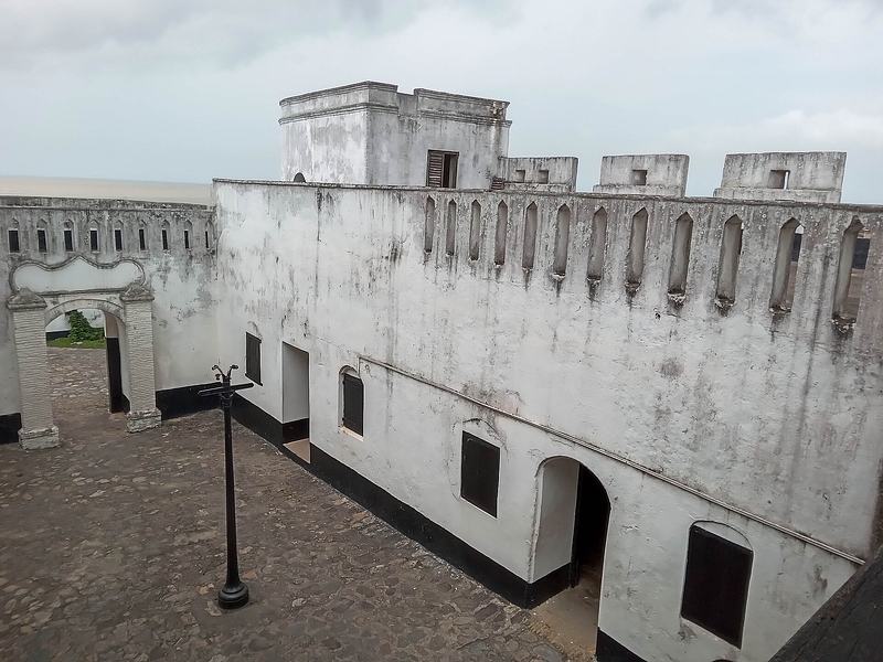
1.Tour Fort San Sebastian
The centrepiece of any visit to Shama. Built by the Portuguese from 1520 to 1526 and later expanded by the Dutch, this is Ghana's third oldest fortification and part of the UNESCO-listed Forts and Castles of Ghana. Its Portuguese and Dutch masonry survives well, and the graveyard holds Anton Wilhelm Amo, the first black European university professor. Because the fort still houses a post office, a magistrate's court and Electoral Commission offices, you are walking through a building in use, not a museum set.
Tip: The fort is a National Monument under the Ghana Museums and Monuments Board; ask locally about access and be ready to wait if court is sitting.
-
Attraction
2.See the Cross in the Sea (White Cross)
A cross standing in the sea off Shama, linked in local accounts to the arrival of Portuguese sailors on the Gold Coast in 1471. A Ghana News Agency report describes being shown a metal-like cross erected at a small island in the sea by Portuguese missionaries, still standing today. It is a modest object with a large claim on Ghana's coastal history — the earliest European landfall on this stretch of coast, generations before the fort was raised.
Tip: It is best seen from the shore or from a boat; ask a local fisherman about the tide and the safest vantage point rather than wading out.
-
Attraction
3.Walk the Pra River estuary and its mangroves
Where the Pra meets the Gulf of Guinea, the estuary spreads into roughly 1,780 hectares of mangrove forest, salt marsh and swamp — a biologically rich system supporting nearly 30 fish species and providing habitat for birds and reptiles. Three mangrove species dominate: Avicennia germinans, Laguncularia racemosa and Rhizophora mangle. It is a working fishery, not a reserve, so you will see set nets, scoop nets and canoes as well as egrets and herons.
Tip: Go with a local guide or fisherman who knows the channels; the mud is soft and the tides move quickly in the creeks.
-
Beach
4.Spend time at Anlo Beach
Anlo Beach is a small artisanal fishing community on a curved sandy shoreline between the Pra River and the sea. Beach-seine fishing is the signature method here: nets up to 1,640 m long are set from a canoe and hauled in by dozens of hands, a spectacle of coordinated effort that has gone on for generations. The community has been the focus of mangrove restoration work, with around 100,000 seedlings planted in 2014 to revive the degraded wetland and the fishery it supports.
Tip: Anlo Beach has suffered severe erosion and flooding, and the district has prioritised resettlement; visit respectfully and avoid walking on the fragile dune edge.
-
5.Watch the canoes come in at Shama's landing beach
Shama is a fishing community first, and the beach is where the town's rhythm is set. The district profile records a long fishing history pre-dating the colonial era, with paddle canoes giving way to outboard motors in the 1960s and the adoption of watsa nets by the 1970s. Drift gill nets, ring nets and hook-and-line crews work the seasons, and the catch is landed, sorted and smoked within sight of the water. Come in the late afternoon when the boats return.
Tip: Ask before photographing people at work, and keep clear of nets being hauled — the crews move fast and the ropes carry real tension.
-
6.Look for the town's older layers
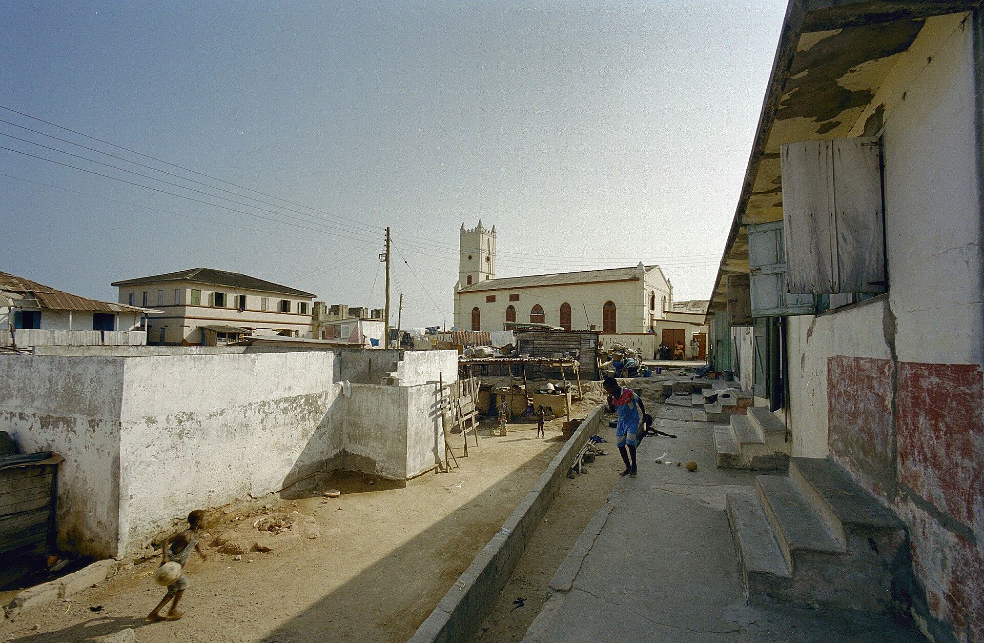
Shama is one of the earliest villages along the Western Region coast, with a history the district profile traces back to the ninth century and to Fante migrants who settled at the site of the present town by Fort St Sebastian. The Shama traditional area is headed by a paramount chief with jurisdiction over the Inchaban, Yabiw and Dunkwa divisions. Walking the lanes around the fort, past the old railway-era houses and the market, gives a sense of a town that has been a port, a trading post and a fishing settlement in turn.
Tip: Greet elders and ask permission before entering palace or shrine areas; a local guide will help you read what is public and what is not.
-
Attraction
7.Play a round at Prah River Golf Links
A private nine-hole golf course at Shama, unveiled in 2009 as part of a wider Shama Beach Resort Limited recreation development. It is an unexpected find on this stretch of coast — a green, manicured counterpoint to the fishing beaches and mangrove creeks nearby. For golfers travelling the Western Region it offers a round in a setting quite unlike the inland courses.
Tip: It is a private facility, so arrange access in advance through the resort rather than turning up unannounced.


Plan your time
Suggested itinerary
Half a day: the fort and the shore
Start at Fort San Sebastian in the morning, when the light is soft and the fort is quiet. Give yourself an hour to walk the ramparts, the courtyard and the graveyard where Anton Wilhelm Amo is buried, and to take in the view over the town and the river mouth. Then walk down to the landing beach and along the shoreline, keeping an eye out for the Cross in the Sea out in the water. Finish with a slow look at the Pra estuary from the bank, watching canoes and set nets against the mangroves. This is a compact, walkable half-day that covers the essentials.
Fort San Sebastian→Cross in the Sea (White Cross), Shama→Pra River Estuary (Pra Estuary), Shama
One day: fort, estuary and Anlo Beach
Begin at the fort as above, then head to the Pra estuary with a local guide for a couple of hours among the mangroves and creeks, learning how the fishery works and why the wetland matters. Break for lunch in town. In the afternoon, travel to Anlo Beach to watch the beach-seine crews haul their nets — the timing depends on the tide, so ask locally the day before. Stay for the late-afternoon light on the water, when the boats come in and the beach fills with activity. If you play golf, a round at Prah River Golf Links can substitute for the estuary walk.
Fort San Sebastian→Pra River Estuary (Pra Estuary), Shama→Anlo Beach (Shama)→Prah River Golf Links
Two days: Shama and the wider coast
Day one follows the one-day plan, ending with the evening landings at Shama's beach. Stay overnight in or near Shama or in Sekondi-Takoradi, about 20 km west. Day two, return to the things you rushed: a longer walk through the old town around the fort, a second visit to the estuary at a different tide, and unhurried time at Anlo Beach talking with fishmongers and fishermen. If the Pra Nye-Eyi Afahye festival falls in your window — it is celebrated in the second week of November — build the day around it instead, since the town's attention will be on the durbar and the streets will be at their liveliest.
Fort San Sebastian→Pra River Estuary (Pra Estuary), Shama→Anlo Beach (Shama)→Cross in the Sea (White Cross), Shama


Seasons and festivals
When to go
Shama sits in Ghana's coastal belt, where the main rains fall through the middle of the year and the drier, brighter months run from roughly November to March. For the sea itself, the district profile notes that major upwelling occurs from late June or early July to late September or early October, with a minor upwelling from January to March — the periods when the fishing is at its most intense and the beaches at their busiest. The harmattan haze of the early dry season softens the light over the estuary, while the wet months bring flooding to the low-lying communities around the Pra, which can cut off roads and isolate settlements. If you want the town at its most celebratory, aim for November.
- Pra Nye-Eyi Afahye · Second week of November
- The festival of the people of the Shama Traditional Area, celebrated in the second week of November. It is a week-long event that usually commences on a Saturday and ends on the Sunday of the following week, bringing the traditional area together around the paramount chief and the three chieftaincy divisions of Inchaban, Yabiw and Dunkwa.
Access
Getting there and around
Shama lies on the coast of the Western Region, about 20 km east of Sekondi-Takoradi, at the mouth of the Pra River. The practical approach is via Sekondi-Takoradi, the region's main city and transport hub, from where the town is a short onward journey along the coastal road. The district is bordered by the Sekondi-Takoradi Metropolitan Area to the west and the Komenda Edina Eguafo Abirem district to the east, with Mpohor Wassa East to the north, so road access follows the coast. Once in Shama, the fort, the landing beach and the estuary are close enough to reach on foot or by short local trips; Anlo Beach and the wider estuary are best reached with a local guide or by arrangement with a fisherman, since the tracks around the wetland are soft and can flood. Travellers exploring the Western Region often base themselves in Sekondi-Takoradi and visit Shama as a day trip.
Good to know
Before you go
Shama is a working fishing town, not a resort, so dress and behave accordingly: cover shoulders and knees away from the beach, greet people before asking questions, and ask permission before photographing anyone at work. The fort is a National Monument and also a functioning post office, magistrate's court and Electoral Commission office, so keep your voice down and stay out of areas that are clearly in official use. The history here is heavy — the dungeons and the tunnel at the fort are part of the story of the transatlantic slave trade, and the graveyard holds the remains of Anton Wilhelm Amo — so visit with the gravity the place deserves. Around the estuary, the ground is soft, the tides move fast and the mangroves are a fragile, restored habitat; follow your guide, take your litter away with you, and do not collect plants or shells. Cash is useful in a town of this size, and the sun and humidity are strong year-round, so carry water and a hat.


FAQ
Questions travellers ask about Shama
Where is Shama in Ghana?
Shama is a fishing town and the capital of Shama District in the Western Region of Ghana, on the coast at the mouth of the Pra River, about 20 km east of Sekondi-Takoradi.
Why is Fort San Sebastian in Shama important?
It is Ghana's third oldest fortification, built by the Portuguese between 1520 and 1526, later expanded by the Dutch, and now a National Monument within the UNESCO-listed Forts and Castles of Ghana. It also holds the grave of Anton Wilhelm Amo, the first black European university professor.
What is the Cross in the Sea at Shama?
It is a cross standing in the sea off Shama, linked in local accounts to the arrival of Portuguese sailors on the Gold Coast in 1471. A Ghana News Agency report describes a metal-like cross erected at a small island in the sea by Portuguese missionaries, still standing today.
Can you visit the Pra River estuary?
Yes, but go with a local guide or fisherman. The estuary covers about 1,780 hectares of mangrove forest, salt marsh and swamp, and the channels, soft mud and fast tides make it unsafe to explore alone.
When is the best time to visit Shama?
The drier months from roughly November to March are the most comfortable, and the Pra Nye-Eyi Afahye festival falls in the second week of November. The major upwelling from late June to early October is the busiest fishing period, while the wet months can bring flooding around the estuary.
Is Shama a good day trip from Sekondi-Takoradi?
Yes. Shama lies about 20 km east of Sekondi-Takoradi, and the fort, the landing beach and the estuary are close together, making the town an easy day trip for travellers based in the city.
What is Anlo Beach known for?
Anlo Beach is a small artisanal fishing community on a curved sandy shoreline between the Pra River and the sea, known for beach-seine fishing and for mangrove restoration work that planted around 100,000 seedlings in 2014.
In pictures
Shama in pictures
Keep exploring
More destination guides
Sources for this guide (10)
- Fort San Sebastian, Shama (1526) — Ghana Museums and Monuments Board
- Fort São Sebastião de Xama — Wikipedia
- Forts and Castles, Volta, Greater Accra, Central and Western Regions — UNESCO World Heritage Centre
- Fort Saint Sebastian — Zamani Project
- Pra Estuary Community-Based Fisheries Management Plan, Western Region, Ghana (MOFAD/Fisheries Commission, 2020)
- Report on Characterization of Coastal Communities and Shoreline Environments in the Western Region of Ghana (CRC/Friends of the Nation, 2010)
- Opinion: The Untold Story Of Fort Sebastian In Shama — ModernGhana/GNA
- Pra — Encyclopaedia Britannica
- Shama District — Wikipedia
- Shama, Ghana — Wikipedia
Written September 29, 2026 from these sources and reviewed by the VisitGhana.app team. Confirm practical details locally before travelling.