
A town at the hinge of the country
Kintampo has always been a crossing place. It became the capital of the Kintampo North Municipal District in 2004, and it sits where the wooded, fertile south meets the drier savannah belt that runs towards Tamale and the Sahel. That position made it a transit point for traders moving between the coast and the north, and it still is: the Kumasi–Tamale highway carries the town's life past its doors. The Bono people are the main ethnic group, and the town's nickname, Kings Town, hints at the pride locals take in it. Alongside the Bono live settler communities including Wangara, Grunsi, Gruma, Konkomba, Mo and Frafra families, a mix that reflects centuries of movement along this corridor. Farming is the backbone of daily life, with yams, maize, cassava, cashew and mango grown on the surrounding land.

The falls, and the memory they carry
The Pumpum River rises near the village of Pumpumatifi and tumbles over sandstone and sedimentary rock in three main drops, the longest about twenty-five metres, before the water disappears under the rocks and reappears downstream. The falls were designated a tourist site in 1992, after being known since the eighteenth century, and were long called Sanders Falls. In March 2017 a severe storm brought down aged trees on visitors at the base of the falls, killing eighteen students from Wenchi Methodist Senior High School and the University of Energy and Natural Resources. The site was closed for safety assessment and reconstruction, and reopened in 2019 with new staircases, an infirmary and a plaque bearing the names of those who died. Visitors today walk a rebuilt and carefully managed site. It is worth pausing at that plaque before heading down to the water.

Forest, farmland and the road north
Kintampo's landscape is a transition zone, and you can read it from the car window. Around the town the vegetation is forest and fertile soil; further north it thins into woodland savannah, where yam production is high across the Bono East Region. The falls themselves are hidden in forest, shaded by tall trees, some of them mahogany growing to more than forty metres. The river's flow is seasonal, swelling in the rains and running clearer in the dry months. This is also a region of older, harder history: at Bono Manso, on the Techiman–Kintampo road, captives from the north were once graded and sorted during the slave trade, with the strongest sent to the coast. That legacy is remembered, and members of the African diaspora still travel to the area to learn about it.

What to do
Things to do in Kintampo
-
1.Kintampo Waterfalls
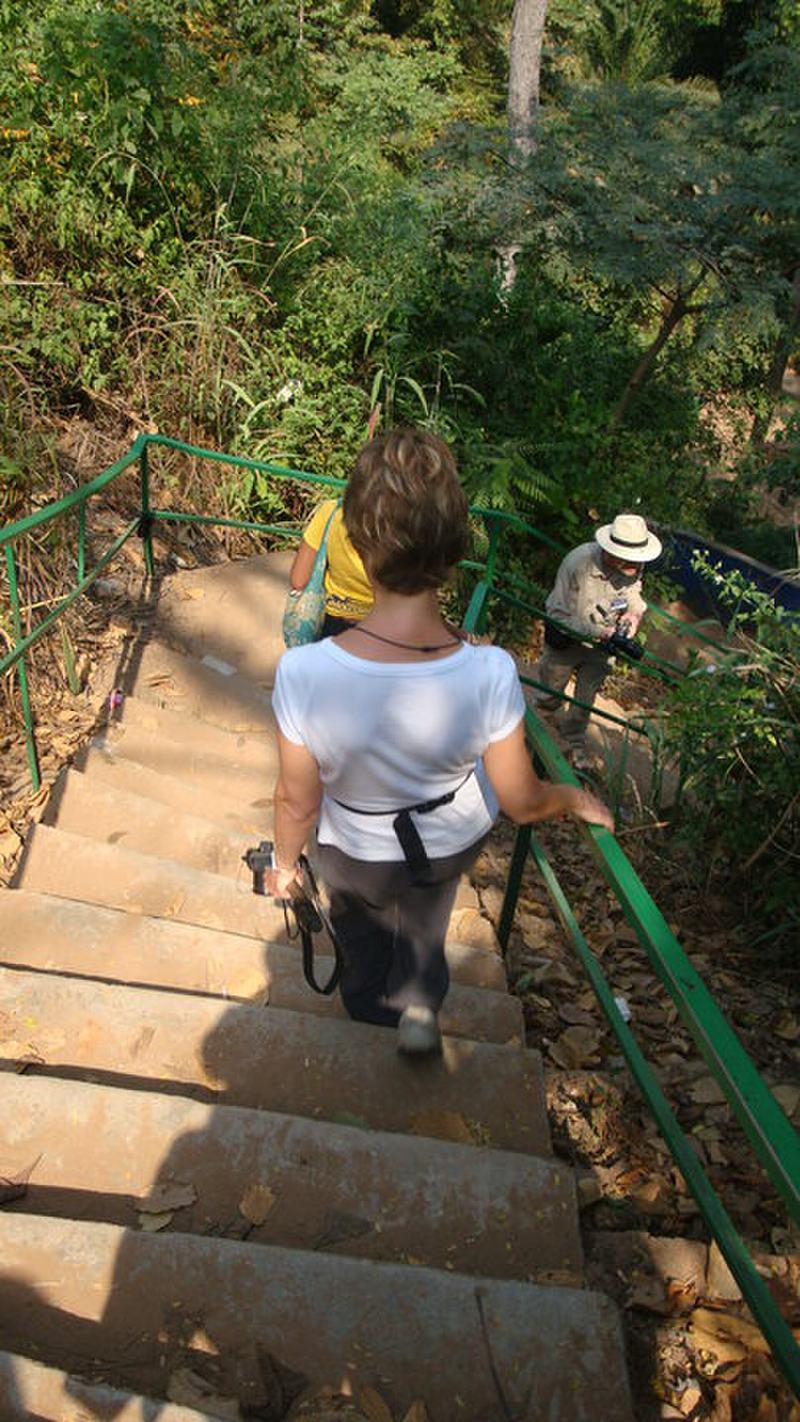
The town's signature sight: a three-drop waterfall on the Pumpum River, about four kilometres north of Kintampo on the Kumasi–Tamale road. The longest single drop is roughly twenty-five metres, and after a series of steps and cascades the river falls about seventy metres in total. The site has a car park, reception centre, trained guides, staircases and a museum, and the base pool is the one place where swimming is permitted. It is a fine place to break a long drive between Kumasi and Tamale or Mole National Park.
Tip: The rock surfaces are slippery and the descent is by staircase, so wear shoes with grip and take your time on the wet steps.
-
2.Kintampo Canopy Walkway
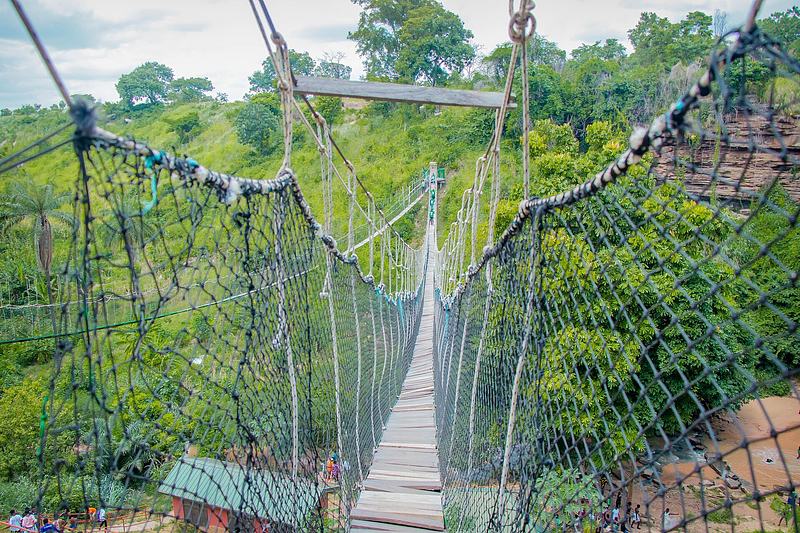
Suspended across the valley above the waterfalls, this two-line walkway was inaugurated in April 2019 and is described as Ghana's second canopy walk after Kakum. It is about eighty by ninety metres and sits roughly a hundred metres above the water level, giving an aerial view of the falls and the forested gorge. Built under a public-private partnership between a Ghanaian firm, the Ghana Tourism Authority, the municipal assembly and traditional authorities, it added a new kind of adventure to a site that had previously been about bathing and sightseeing.
Tip: The walkway is a suspended structure over a valley, so cross in small groups and keep hold of children and loose items.
-
3.Fuller Falls
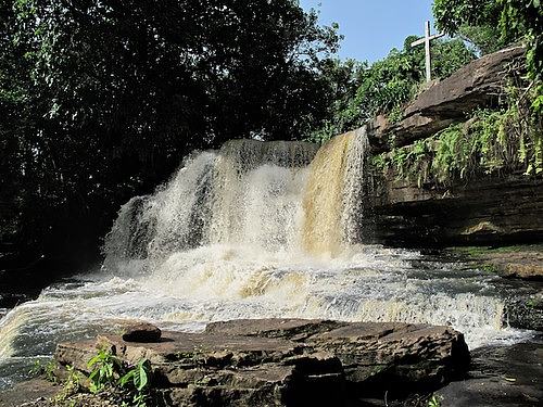
About seven kilometres west of Kintampo, at the village of Yabraso, the Oyoko River slides gently over a series of cascades and foaming rapids rather than plunging. The falls were found in 1988 by a Filipino missionary, Rev. Fr Joseph Panabang, who kept the spot as a prayer ground called Our Lady of Kintampo Prayer Park until he left in 1998. Today a cold, clear pool is ringed by seats of concrete and rock, making it a calmer, quieter counterpoint to the busier main falls.
Tip: Fuller Falls is a good pairing with the main falls on the same day; ask a local driver to wait, as the site is rural and transport back can be scarce.
-
Attraction
4.Centre of Ghana Monument
In the heart of town, a small monument marks the point identified in colonial times as Ghana's geographical centre, with the national flag hoisted above it and the Coat of Arms once mounted on the surrounding wall. It sits next to the old police station, about a hundred metres from the Techiman–Tamale highway. The structure has suffered from neglect, but it remains a genuine landmark and a favourite spot for a photograph at the middle of the country.
Tip: Entering the central business district, take the first paved road to the left past the Okumah Executive Lodge and look for the monument on your left.
-
5.Walk the forest around the falls
The waterfall site is set in forest, with tall shade trees and a network of paths and staircases linking the three stages of the falls. The first two stages are reached over fairly level ground, while the third descends by staircase to the main drop. Guides at the reception centre can point out the trees and the cave behind the falls, which shelters a colony of bats, and the rock where it is said Kwame Nkrumah once sat to read and meditate.
Tip: Take a guide from the reception centre if you want the natural and human history explained; the site is large and the paths are not all signposted.
-
6.Explore Kintampo's market and town
Kintampo is a working commercial town as much as a tourist stop, and its market and streets show the trade that has always passed through here. The town serves as a major transit point for traders moving between the north and south and the wider sub-Sahel, and its economy runs on yams, maize, cassava, cashew and mango from the surrounding farms. Wandering the centre gives a sense of the place beyond the waterfalls, and the British Cemetery, once used for members of the Gold Coast Regiment, is another reminder of its layered past.
Tip: Go in the morning when the market is at its liveliest, and carry small change for everyday purchases.


Plan your time
Suggested itinerary
Half a day
Arrive from Kumasi or Techiman and head straight for the Kintampo Waterfalls, about four kilometres north of town on the Kumasi–Tamale road. Spend an hour or two walking the forest paths, descending the staircase to the base of the main drop and, if you wish, swimming in the permitted pool. Then cross the Kintampo Canopy Walkway for the aerial view over the valley. On the way back into town, stop at the Centre of Ghana Monument for a photograph at the country's geographical centre before continuing your journey.
Kintampo Waterfalls→Kintampo Canopy Walkway→Centre of Ghana Monument (Kintampo)
One day
Start early at the Kintampo Waterfalls, taking a guide to explain the three stages, the bats' cave and the forest trees, and allow time for the canopy walkway. Break for lunch in town, then drive about seven kilometres west to Fuller Falls at Yabraso, where the Oyoko River spills over gentle cascades into a cold pool ringed by seats. Finish with a wander through Kintampo's market and a look at the Centre of Ghana Monument, and the British Cemetery if you have time, before an evening departure or an overnight stay.
Kintampo Waterfalls→Kintampo Canopy Walkway→Fuller Falls→Centre of Ghana Monument (Kintampo)
Two days
Day one: the Kintampo Waterfalls and canopy walkway in the morning, lunch in town, then the Centre of Ghana Monument and the market in the afternoon, with an overnight in Kintampo. Day two: an early drive west to Fuller Falls for a quiet hour by the pool, then use Kintampo's position on the Kumasi–Tamale corridor to continue north towards Mole National Park or south towards Kumasi and Techiman, breaking the journey at the falls rest stop on the highway.
Kintampo Waterfalls→Kintampo Canopy Walkway→Centre of Ghana Monument (Kintampo)→Fuller Falls


Seasons and festivals
When to go
Kintampo sits in a transition belt where the climate is generally mild, with a dry season from December to April and a wet season running roughly from July to November. The Harmattan wind blows frequently between December and the beginning of February, dry and dusty, with temperatures that can swing from around 14°C at night to 40°C by day. The falls are seasonal: the river's volume peaks during the rains from May to October, while the dry months from November to March bring clearer water and easier access. The last quarter of the year is regarded as the peak season for visitors to the falls. The Kurubi festival, celebrated by the people of Kintampo in November, brings together people of Wangara descent, and virgins traditionally dance on stilts as part of the celebrations.
- Kurubi festival · November
- Celebrated by the people of Kintampo, this festival is mainly intended to unite all Wangara descent in Ghana. Virgins traditionally dance on stilts as an interesting part of the celebrations.
Access
Getting there and around
Kintampo lies off the Kumasi–Tamale highway and is easily accessible by public transport, which makes it a natural stop on the long road between southern and northern Ghana. The waterfalls are about four kilometres north of the municipality on the Kumasi–Tamale road, just after the Falls Rest Stop when travelling northwards, on the right-hand side. Fuller Falls is about seven kilometres west of Kintampo at Yabraso, reached by road from the town. The Centre of Ghana Monument is in the heart of town, roughly a hundred metres from the Techiman–Tamale highway. Within Kintampo, taxis and local transport serve the town and the nearby sites, and the falls are close enough to the highway to fit into a journey north or south.
Good to know
Before you go
Kintampo is a busy transit town, so plan around the road rather than against it: the falls sit right on the Kumasi–Tamale highway and are easiest to visit as part of a longer journey. Wear shoes with grip for the wet, slippery rocks and the staircases down to the base of the falls, and take water and sun protection, as the Harmattan months are dusty and the afternoons hot. Swimming is allowed only at the base of the main drop, and only where the site's guards indicate; follow their instructions and the posted rules. Treat the 2017 memorial plaque and the site's safety measures with respect. At Fuller Falls, which is quieter and more rural, arrange your transport to wait or return for you. Carry small change for everyday purchases, and ask before photographing people in the market or at the monument.


FAQ
Questions travellers ask about Kintampo
Where is Kintampo in Ghana?
Kintampo is a town in the Bono East Region of Ghana and the capital of the Kintampo North Municipal District. It lies on the Kumasi–Tamale highway, close to the point identified in colonial times as the country's geographical centre.
How far is Kintampo Waterfalls from the town?
The falls are about four kilometres north of Kintampo municipality, on the Kumasi–Tamale road, just after the Falls Rest Stop when travelling northwards. They sit on the right-hand side of the road.
Can you swim at Kintampo Waterfalls?
Swimming or bathing is permitted at the base of the main drop, the third stage of the falls, but not at the first two stages. Follow the instructions of the site's guards and the posted rules, and take care on the slippery rocks.
What is the Kintampo canopy walkway?
It is a suspended two-line walkway across the valley above the waterfalls, inaugurated in April 2019 and described as Ghana's second canopy walk after Kakum. It is about eighty by ninety metres and roughly a hundred metres above the water level.
What is there to see at Fuller Falls?
Fuller Falls is a multi-step waterfall on the Oyoko River at Yabraso, about seven kilometres west of Kintampo. The river flows gently over cascades into a cold, clear pool surrounded by seats of concrete and rock, making it a quieter alternative to the main falls.
Why is Kintampo called the Centre of Ghana?
Kintampo is the geographical centre of Ghana as measured in colonial times. The exact point is marked by a monument in the heart of town, with the national flag hoisted on it, next to the old police station.
When is the best time to visit Kintampo?
The falls are seasonal, with peak water volume during the rains from May to October and clearer water and easier access in the dry season from November to March. The last quarter of the year is regarded as the peak season for visitors.
In pictures
Kintampo in pictures
Keep exploring
More destination guides
Sources for this guide (8)
- Kintampo Waterfalls – Visit Ghana
- Fuller Falls – Visit Ghana
- Kintampo waterfalls – Wikipedia
- Kintampo, Ghana – Wikipedia
- Bono East Region – Wikipedia
- Kintampo! Let's go to the Centre of Ghana – Graphic Online
- Bawumia reopens Kintampo Waterfalls – Graphic Online
- Kintampo Waterfalls Canopy draws more tourists – GhanaWeb
Written September 29, 2026 from these sources and reviewed by the VisitGhana.app team. Confirm practical details locally before travelling.